CONFIDENTIAL
HH-26001
Derinkuyu Underground City
- Incident
- 1963-01-01
- Location
- Derinkuyu, Nevşehir Province, Cappadocia, Turkey
- Coords
- 38.3735, 34.7344
Brief
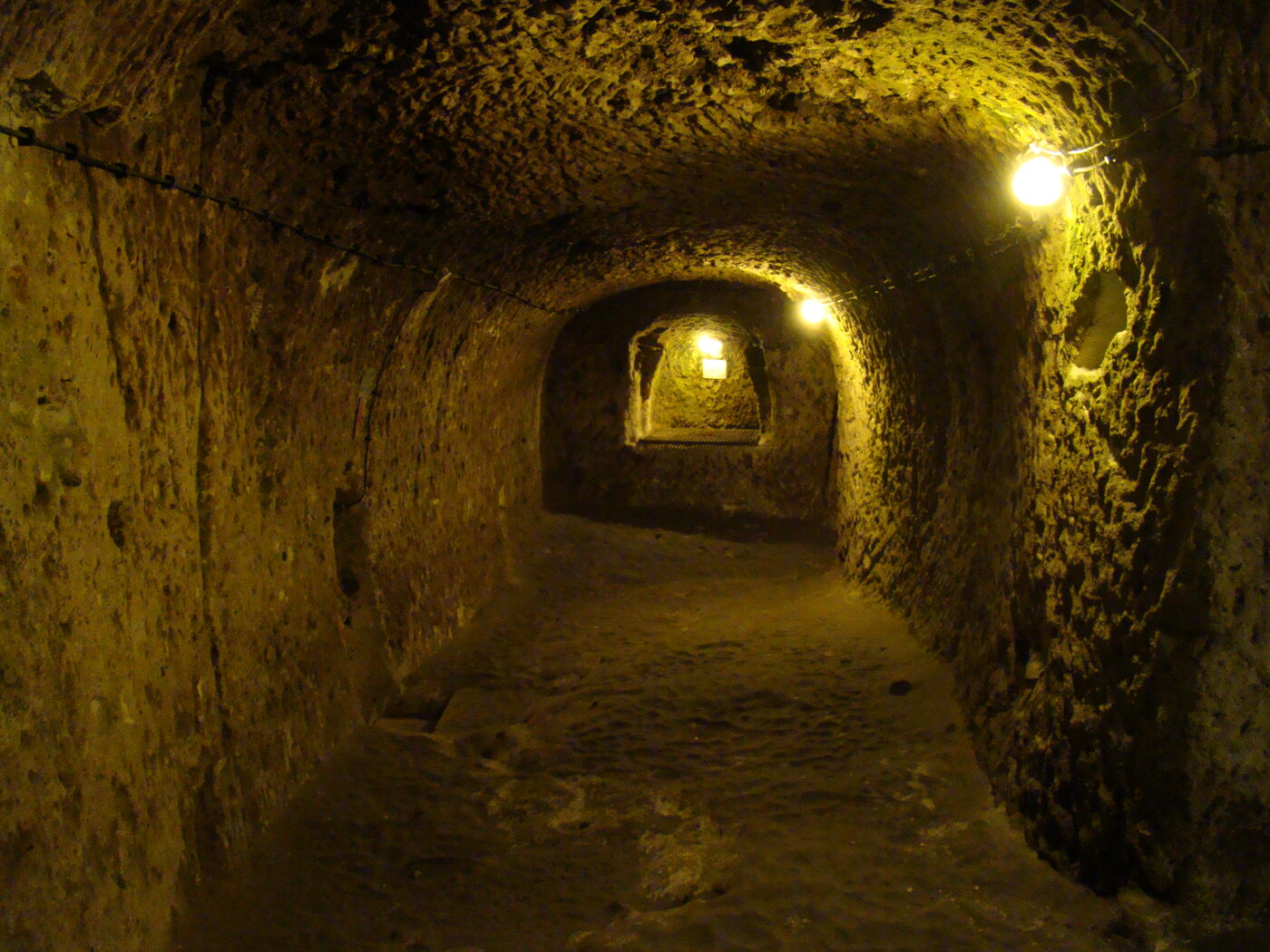
Derinkuyu is a multi-level subterranean settlement carved into soft volcanic tuff in the Cappadocia region of central Anatolia, descending as far as 85 metres through as many as 18 levels. Peer-reviewed engineering studies report it could have sheltered on the order of 20,000 people; it was rediscovered in 1963 during the reconstruction of a house and opened to visitors in 1969. Its date of original construction is not precisely established in the primary literature.
Filed 2026-06-20 · Last updated 20 June 2026
Briefing
Derinkuyu is a multi-level subterranean settlement carved into the subsoil
of central Anatolia, in the Cappadocia region’s lost-civilisation
record [1]. The complex was cut into
easily-worked pyroclastic rock — volcanic tuff formed from material ejected
near the contact of the Anatolian and Arabian tectonic plates — and descends as
far as 85 metres through as many as 18 floors [1][2]. Peer-reviewed
engineering studies report it could have sheltered on the order of 20,000
people, though that figure is an estimate rather than a measured count [1][2].
Sequence of events
- Construction — undated. The time of origin is not precisely dated in the
primary literature; many authors date the site to the period of the Hittites,
though no primary Hittite-period document tying the site to that civilisation
was located [1].
- Continuous use until the nineteenth century. Underground spaces in the
region are reported to have been used until the nineteenth century and then
forgotten — a claim stated without primary citation in the source [1].
- 1963 — rediscovery. The city was found “relatively recently in 1963 when
the reconstruction of [a] house was made” [1]. No named individual discoverer
is identified in any of the primary or peer-reviewed sources reviewed [1][2].
- 1969 — opened to visitors [1].
Documentary record
The principal contemporaneous engineering account is the 2016 Procedia
Engineering case study by Nývlt, Musílek, Čejka and Stopka of the Institute of
Technology and Business in České Budějovice, which supplies the core figures:
up to 18 floors, a deepest floor at up to 85 metres, capacity up to roughly
20,000, more than 50 ventilation shafts, a single defended entrance, the tuff
geology, the 1963 rediscovery and 1969 opening, and the Hittite-origin theory
[1]. The complex is described as occupying roughly 2,500 m² dispersed across
its 18 levels, with the depth and extent attributed to the underlying 2013
geomechanical study by Aydan and Ulusay [2].
Recorded interior spaces span small caverns used as tombs and large caverns
serving as schools, religious and social gathering rooms, bedrooms, kitchens,
bathrooms, stables, water tanks, wells, food and wine storage, burial places
and a weapons depot [1]. Defence was structural: a single main entrance
protected by a large circular (“millstone”) stone door with a retractable
system, with the stone doors between floors openable only from the inside
[1][2]. More than 50 ventilation shafts allowed air to circulate unaided so
that even the lowest and most remote parts remained ventilated [1].
The underlying primary geomechanical study — Aydan and Ulusay (2013), Rock
Mechanics and Rock Engineering 46:731–754 — is referenced and quoted from by
both later works but is paywalled and was not directly retrieved; its specific
figures are therefore reported here via the two sources that cite it [2].
Open questions
- When was Derinkuyu first cut, and by whom? The primary sources state
plainly that the time of origin “is not precisely dated”; the Hittite
attribution is offered by “many authors” but unsupported by any located
primary document [1].
- Is Derinkuyu connected to Kaymaklı? The two cities are reported to lie
9 km apart, and a connecting tunnel is “assumed but not proven” [1].
- How were the underground cattle fed? The source calls this “a mystery”,
noting feed must have come from the surface — itself a security risk [1].
- What is the true population figure? Capacity numbers are estimates, not
measured counts, and are framed inconsistently: one source states ~20,000
plainly while the other hedges it as what “some believe” [1][2].
- No formal archaeological excavation report for Derinkuyu was found in any
reviewed source [2].
Status
This file is CONFIDENTIAL — admitted on the strength of two peer-reviewed
engineering and urban-morphology studies whose figures corroborate one another
on floor count, depth and defensive layout [1][2]. The structure, geology and
modern history (1963 rediscovery, 1969 opening) are documented; the ~20,000
capacity, the nineteenth-century-abandonment account and the
Derinkuyu–Kaymaklı tunnel are reported or unverified and are held at a
lower confidence accordingly [1][2]. The popular retellings — a resident
breaking through a cellar wall with a sledgehammer, or precise datings to the
Phrygians or Byzantine-era Christians — could not be traced to any primary or
peer-reviewed source and are excluded. Notably, the absence of any formal
excavation report places Derinkuyu among the
forgotten empires whose record rests on
secondary study rather than primary dig documentation. Updates pending a
directly-retrieved copy of the Aydan and Ulusay (2013) study.
References
- Nývlt, V., Musílek, J., Čejka, J. & Stopka, O. (2016). The Study of Derinkuyu Underground City in Cappadocia Located in Pyroclastic Rock Materials, Procedia Engineering, vol. 161, pp. 2253–2258 (open access, CC BY-NC-ND 4.0).
- Andersen, A. (2022). The Underground Cities of Derinkuyu and Naours through the Lens of Urban Morphology, The College of Wooster, Archaeology Program (symposium poster). Independently cites the 18-level / 85 m / ~2,500 m² figures, attributing depth and extent to Aydan & Ulusay (2013), and notes these sites “do not have available excavation reports or abundant literature”. Licence unverified.