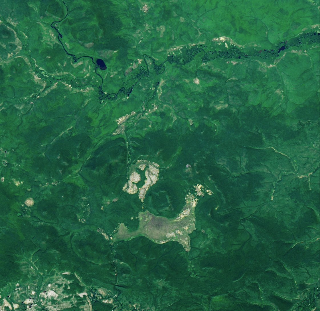
Briefing
On the morning of the thirtieth of June 1908, something exploded in the sky over
central Siberia. It flattened roughly two thousand square kilometres of forest,
was heard hundreds of kilometres away, and registered on instruments in Irkutsk
and in Britain. Nobody went to look at the forest for nineteen years.
That gap is the first thing to understand about this case. The event is not in
doubt; the instrumental record fixes it to that morning. What is in doubt is
almost everything about the object that caused it — its size, its composition,
the energy it released, and where any of it went. This file sits among the
archive’s cold cases for that reason: the file was
never closed so much as exhausted.
Sequence of events
The affected area lies in the basin of the Podkamennaya Tunguska river, in what
is now Krasnoyarsk Krai. The nearest settlement of any kind was the trading post
at Vanavara, about sixty-five kilometres to the south-south-east. Beyond that there
was taiga: swamp forest, almost no roads, and a population measured in scattered
families.
The event was recorded at a distance before anyone described it up close.
Seismographs registered it, microbarographs in Britain picked up the pressure
wave, and for several nights afterwards the skies over northern Europe were
bright enough to read by [3]. All of that is instrumental and all of it is dated
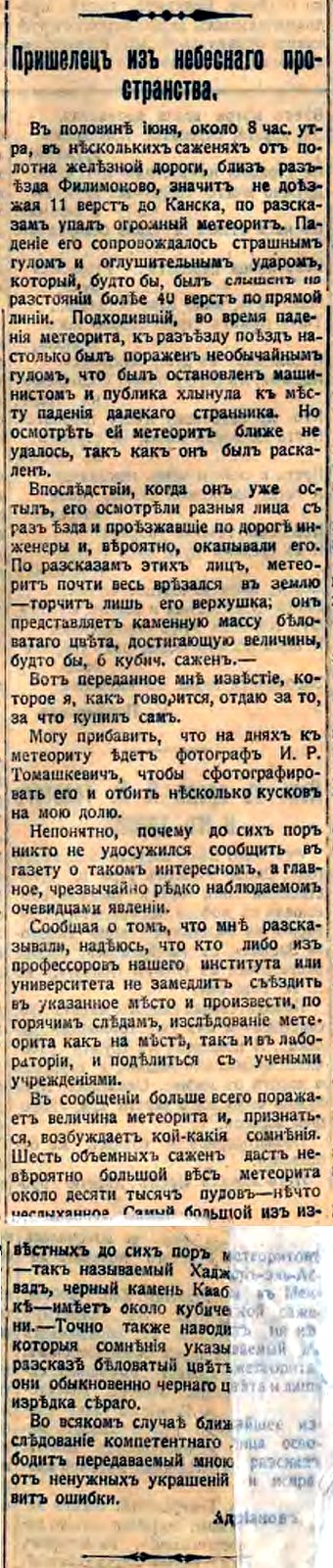
to that morning. Contemporary press in Tomsk carried reports within weeks,
uncertain whether what had happened was a meteor, lightning or an earthquake [1].
At Vanavara, a man sitting on the porch of the trading post described the sky
splitting in two above the forest, a heat on his face he compared to his shirt
catching fire, and then a blow that threw him from the porch. Closer in were the
Evenki, reindeer herders whose camps and herds lay inside the affected area;
their accounts describe the ground moving, tents thrown down and animals killed.
Those accounts were not collected systematically until the 1920s, by which time
they were memories nearly two decades old [2].
Nobody investigated for nineteen years, and the reason is unglamorous rather
than sinister. The site is extremely remote, the Russian Empire had other
problems in 1908, and within a decade there was a world war, a revolution and a
civil war between the event and anyone who might have funded an expedition.
The man who eventually went was Leonid Kulik, a mineralogist at the Academy of
Sciences in Leningrad who specialised in meteorites and who was the first to
raise the event in the scientific press. He believed a large iron meteorite had
fallen, and he expected to find it. His first problem was that he was looking in
the wrong place: working from reports of damage, Kulik initially placed the
impact site in the basin of the river Ognia, roughly sixty kilometres east of
the forest fall, and moved his search only after hearing that a very large area
of flattened forest existed somewhere else entirely [1]. What redirected him was
ethnography — in 1926 I. M. Suslov interviewed more than sixty Evenki witnesses
and published the accounts the following year [2].
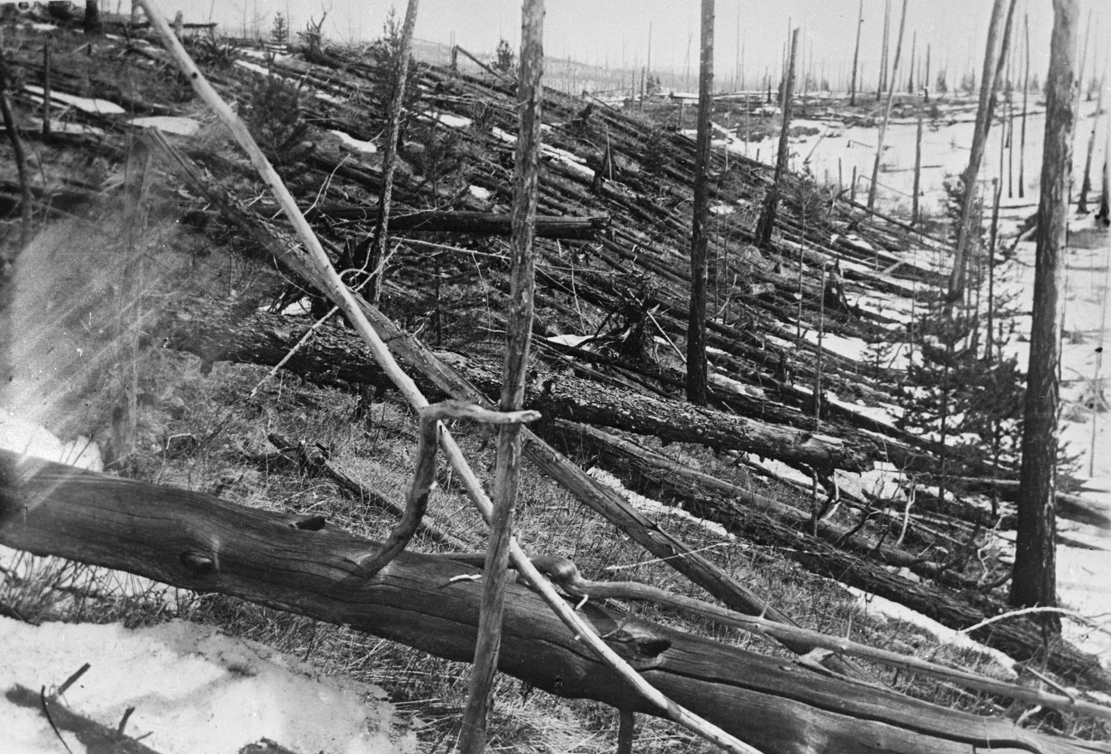
Kulik reached the forest fall in 1927. He found trees lying flat and stripped of
branches, pointing outward from a common centre, across an area he could not see
across. At the centre the trees were still standing — bare and dead, but upright.
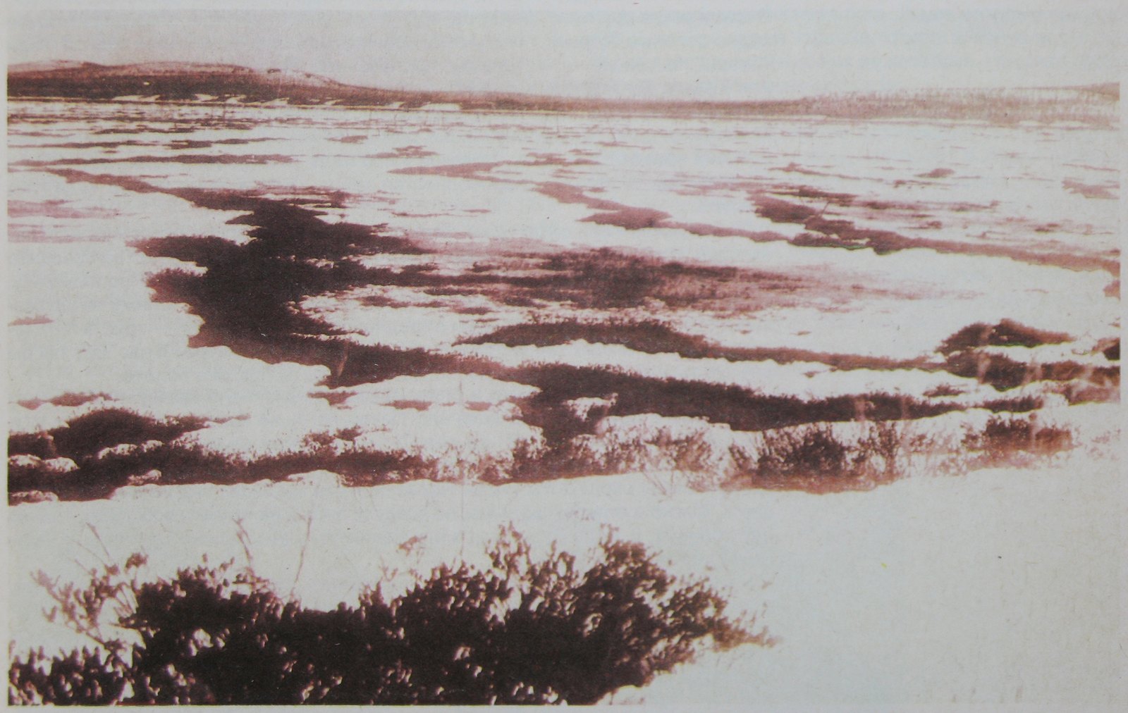
Scattered across the ground were circular, water-filled pits between ten and
fifty metres across; Kulik took them for fragment craters and began to dig. He
returned in 1928, and again in 1929–30 with better equipment and a drilling
programme. Across every expedition, not one fragment of meteoritic material was
recovered [1]. In 1938–39 he organised an aerial photographic survey of the
fall, recording the direction of the fallen timber across country no ground
party could cover; those frames are still being read today [1][4]. Kulik himself
died in 1942, a prisoner of war.
The work that produced actual numbers began in 1960, when the Committee on
Meteorites of the Soviet Academy of Sciences, working with a volunteer
expedition group known by its initials KSE, started a systematic survey that ran
for roughly two decades. The resulting catalogue of treefall directions was
published in two parts, in 1967 and 1983 [5], and unified against standard
geographic coordinates in 2005 [4]. The one candidate crater proposed since —
Lake Cheko — was put forward in 2007, rebutted in 2008, and dated older than
1908 in 2017 [6][7][8].
Documentary record
The surveyed treefall
The position of the epicentre — approximately 60.9° N, 101.9° E — was
established by the KSE group in the 1960s, not in 1908 and not by Kulik [1].
Their method is the part of this story that is almost never told, and it is the
part that makes the famous picture real. In 1961 they laid a grid across the
whole fall, with trial plots on average every two kilometres. Each plot covered
between a quarter and a half of a hectare, sized so that roughly one hundred
fallen trees lay inside it. In each plot they recorded the direction the trees
were pointing and averaged it. Then they moved two kilometres and did it again,
for years [5].
The 2005 unified catalogue contains 1,165 directions drawn from the original
ground survey, eighty more from a separate 1967 dataset, and 350 read off
digitised aerial survey photographs — nearly sixteen hundred measured
directions, each carrying a grade for how reliable it is [4]. So the outline
everyone has seen, the one usually described as a butterfly, is not an artist’s
impression of a blast. It is the result of counting trees on the ground, plot by
plot, and plotting which way each group of them points.
What the field of directions says is consistent: the trees point outward from a
centre. The shape is not a perfect circle, and that asymmetry is what the
modelling has to explain. The fall also thins out quickly a few kilometres west
of the epicentre — a fact about severity that a map of directions alone does not
show [1].
The explanation that fits the ground is an airburst. A body entering the
atmosphere at high speed is destroyed by the pressure in front of it and
releases its energy as a shock wave in the air, at altitude. The body itself is
usually modelled as a stony asteroid or a fragment of a comet, in the region of
fifty to sixty metres across — a figure inferred from the damage, since nothing
of it has ever been recovered. For Tunguska the burst height is generally put
between five and ten kilometres [3]. The standing
trees at the centre are part of the same evidence: trees survive upright
directly beneath a blast because the force there arrives along their own axis.
The figure almost always quoted is around fifteen megatons — “a thousand
Hiroshimas.” That comes from scaling the observed damage against nuclear-weapon
blast effects, and estimates derived that way run from about ten to fifteen
megatons, with some as high as thirty. Later work using supercomputer modelling
puts it far lower, at roughly three to five megatons [3]. The reason is not that
the measurement improved. It is that an airburst is not a nuclear detonation: it
carries momentum downward, so it does more damage per unit of energy, and the
same flattened forest therefore requires a smaller explosion.
Those two figures differ by about a factor of four and both are in current use.
Any account that gives one of them as the answer has made a choice on the
reader’s behalf.
The same caution applies to the trees. “Eighty million” is the figure in almost
every retelling; other sources give thirty million for the same area. The area —
roughly 2,000 to 2,150 km² — is a measurement. The tree count is an estimate
derived from it, and an estimate that varies by a factor of nearly three should
be described as one.
The missing object
There is no crater, and that absence is the strongest single argument that the
object exploded in the air. A body reaching the ground intact leaves a hole,
shocked rock and recoverable material; Tunguska has none of the three. Unlike
the Younger Dryas impact hypothesis,
where the argument turns on microscopic impact markers in sediment layers, here
there is no candidate material to contest at all.
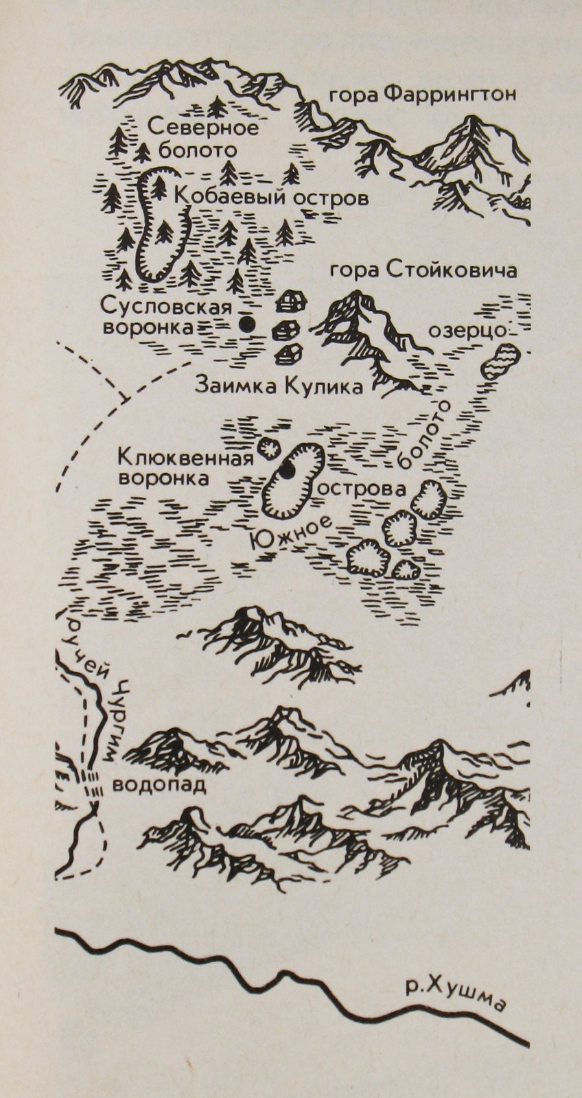
One object sits in the record and it is a frustrating one. A piece of glassy,
bubbled material weighing about half a kilogram was recovered near the
depression that now carries Suslov’s name, and Kulik associated it with the
event. The specimen was subsequently lost. It cannot be re-examined, so it
cannot count as evidence [1].
Lake Cheko
In 2007 a team led by Luca Gasperini proposed a candidate crater. Lake Cheko, about eight
kilometres north-north-west of the epicentre, might have been gouged by a
surviving fragment; caesium-137 and lead-210 dating put a transition in the
lake’s sediments close to 1908 [6]. Their own paper is careful about what it
could not do: the cores reached a maximum of 1.80 m and did not reach the level
the proposed impact would have produced, so by the authors’ account the sampling
could neither confirm nor reject the hypothesis [6].
The following year Gareth Collins and colleagues argued the lake is simply the
wrong shape — its
depth-to-diameter ratio far too low for a young impact crater, and no rim — and
that a stony fragment would need a tensile strength an order of magnitude beyond
what such bodies possess to reach the ground intact [7]. The original team
replied in the same issue that soft, waterlogged ground could have collapsed
after the fact [7]. Neither party withdrew. In 2017 a study led by Denis Rogozin dated two
sediment cores from the lake and concluded it is older than 1908 [8]. Most of
the literature since has treated the crater possibility as closed. The honest
reading is that it leans strongly against, which is not quite the same as
settled.
Open questions
The nineteen-year gap is more awkward than it first appears. The association of
the Kulikovskii forest fall with the morning of 30 June 1908 rests on Evenki
testimony: seismic and barometric instruments recorded an event that morning
at a distance, but no instrument tied that forest to that date, and no
investigator reached the forest for nearly two decades [1]. The chronology is
simple fact. Readings built on it that go further — including the non-impact
geophysical hypothesis argued by the author who catalogues this point — are not
in the record and are not adopted here.
Evenki witnesses also described several other, smaller areas of flattened forest
from the same morning, which received little attention because they were
small [2]. Whether they belong to this event is not established, and nobody has
ruled them out.
The case is not only historical. In 2013 a far smaller body exploded over
Chelyabinsk, injuring around fifteen hundred people, almost all of them from
glass blown in by the shock wave, and it was detected by nobody in advance [9].
Tunguska remains the largest event of its kind in recorded history, and it is
the one used to calibrate the risk.
Status
CONFIDENTIAL tier reflects a case whose central event is thoroughly documented
while its cause remains open. What is settled: an enormous quantity of energy
was released in the atmosphere over Siberia that morning, instruments recorded
it, and the forest beneath it records a radial airburst pattern that has been
surveyed in detail. What is not settled: how large the object was, what it was
made of, and where any of it went.
Outstanding: the raw azimuth tables behind the 2005 unified catalogue are not
published — the hosting institution’s pages carry the map images, the conference
abstract and a book chapter, but no coordinate lists or data files. A release of
those tables would allow the treefall field to be re-analysed independently for
the first time.
More than a century on, the morning of the thirtieth of June can be described
in considerable detail. The forest was measured plot by plot, by people who
walked a grid for twenty years. The object has never been found.
References
- A. Ol’khovatov, “The 1908 Tunguska event and forestfalls,” arXiv:2110.15193, 2021. Cited for the chronology, the epicentre’s provenance and the catalogue history it documents; its non-impact interpretation is not adopted here.
- A. Ol’khovatov, “The Evenki accounts of the 1908 Tunguska event collected in the 1920s–1930s,” arXiv:2402.10900, 2023; I. M. Suslov’s 1926 interviews, published 1927. Same caveat.
- “Tunguska event,” Encyclopaedia Britannica — date, burst-altitude range and the competing energy estimates.
- G. Longo, M. Di Martino, G. Andreev, J. Anfinogenov, L. Budaeva and E. Kovrigin, “A new unified catalogue and a new map of the 1908 tree fall in the site of the Tunguska Cosmic Body explosion,” in Asteroid-Comet Hazard-2005, pp. 222–225, Institute of Applied Astronomy of the Russian Academy of Sciences, St. Petersburg, 2005.
- W. Fast et al., treefall azimuth catalogue, parts I and II, 1967 and 1983; survey method as described in Boyarkina et al., 1964.
- L. Gasperini et al., “A possible impact crater for the 1908 Tunguska Event,” Terra Nova 19(4):245–251, 2007.
- G. S. Collins et al., “Evidence that Lake Cheko is not an impact crater,” Terra Nova 20(2):165–168, 2008, and the authors’ reply, Terra Nova 20(2):169–172, 2008.
- D. Rogozin et al., sediment-core dating of Lake Cheko, 2017.
- O. P. Popova et al., “Chelyabinsk airburst, damage assessment, meteorite recovery, and characterization,” Science 342(6162):1069–1073, 2013.